In the rush to publish the previous post about my Middle Egypt KML trip report (I was also packing for a day just spent travelling) I forgot to mention several further points I had on my mental to-do list:
- Google Earth + iPhone = awesome ruin navigation tool: While the iPhone isn’t any good for making tracks, it was a most excellent mobile Google Earth — Especially in Egypt, where the base imagery is 2.5m Spot Image instead of 15m used elsewhere, and where most archaeological sites have glorious high-resolution DigitalGlobe imagery, the result of many special requests by archaeological institutes over the years.
My iPhone happens to be locked to a Swedish contract, which implies ridiculously expensive data rates abroad, so I don’t do mobile surfing with it while in Egypt. (When-oh-when will EU regulators call this practice what it is — cartel pricing — and make it illegal for European carriers?). I do, however, surf on hotel wifi (provided free even in the cheap ones) so during my trip, I spent some time each evening visiting the next day’s sites on my iPhone.
Since Google Earth for iPhone keeps its imagery in a huge cache, I don’t need to connect to the internet later to use Google Earth while in the field — all the imagery is right there in the cache from the night before.
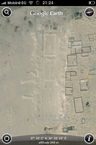
On several occasions while traipsing around Akhetaten (aka Amarna) we all ended up huddling around the iPhone to better see the view from above in Google Earth, zooming and rotating until we could identify the feature right in front of us.
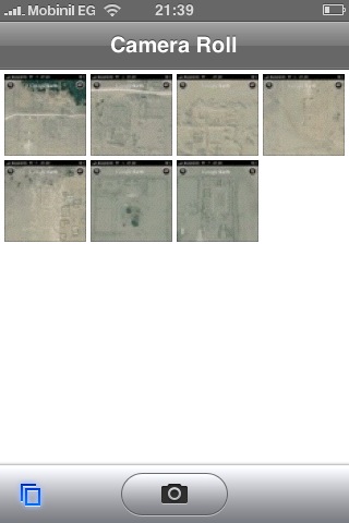
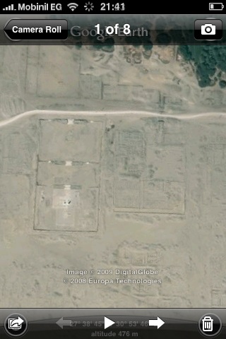
I also ended up using a trick that makes flicking between favorite views a lot faster: The night before, I’d set up good views of a site and then take snapshots of the screen. (While keeping the Home button pressed down, hit the on/off button). After a while, I’d have a folder of Google Earth views ready for browsing on the iPhone without the startup lag or processing cycles of Google Earth (which helps preserve batteries). For example:
(One more thing (so much minutiae:-) — GPS on the iPhone without an internet assist (The A in A-GPS) makes i as slow as a dog, much like the early days of the Nokia N95. So if you turn off roaming data while abroad to save money, you can forget about getting a fix in anything near a reasonable time, if at all. Another win for a dedicated GPS unit.)
- Google Earth panorama FOV bug: If you fly into a 360-degree panorama via the current version of Google Earth, you’ll notice that you can’t really zoom out all that much to get a wide-angle field of view. That turns out to be a known bug, as 360Cities’ Jeffrey Martin pointed out to me.
To see the difference, view the same panorama in 360Cities’ web viewer (click on the link at the bottom of the popup window.)
- Imagery positioning in Google Earth: I’ve been faced with this dilemma before: In Cairo, the road layer in Google Earth is positioned about 125m northwest of the imagery layer, so which should I use as a reference when contributing placemarks to the neogeo commons? I’ve been using the imagery layer, as it appears that the road layer was published to an older datum before being released to the public domain — and all mapping services have the same problem.
But now, after using a Garmin Oregon 300, one of the new generation of GPS devices with accuracy that routinely surpasses 5m, I’ve had a chance to compare that imagery layer in Google Earth to some real world locations, only to find that you can’t assume the the accuracy of the positioning of the imagery matches the imagery’s resolution.
I should have known this, of course, but until now I have been blissfully placing placemarks with great care, to within the meter if the resolution of the imagery allowed it. Such confidence I now realize is misplaced, though for a while I wondered if the disparity wasn’t due to some kind of systemic drift in the GPS signal, or improperly orthorectified images — it looked like the higher I climbed the cliffs of the Nile valley, the more divergent the track became. But then the obvious answer was to be found at the seams of the imagery mosaic:
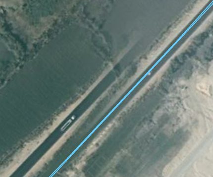
The above seam is between two DigitalGlobe imagery tiles taken on the same day and part of the same strip, just south of El Minya. There is more where that came from:
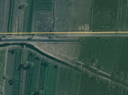
It turns out some tiles are just better positioned than others.
As a result, the KML trip report’s georeferenced photos are now faithful not to the base imagery but to the GPS track, even if they look misplaced — because one day soon an imagery update will produce more accurately positioned imagery, which means in turn that placemarks previously placed using the imagery as a reference will suddenly be off-target.
Of course, Google Earth doesn’t come with any guarantees for accuracy, and accurately positioning a globe’s worth of imagery is a gargantuan task, but it is good to keep in mind that Google Earth’s imagery is not the gold standard when it comes to goereferencing a location. GPS units are.
Another big factor in the accuracy of the position in GE is the underlying 3D terrain model. In Egypt the terrain model for GE is not very accurate. So, the imagery will not “stretch” properly causing problems especially around the hilly areas you were examining.