I’m in China to manage Sweden’s web-based public diplomacy effort aimed at the Chinese. The catalyst is Shanghai Expo 2010, a world fair whose sheer ambition will blow all previous efforts out of the water — as is the custom here in China. Sweden will have a pavilion at the Expo, and the groundbreaking for it took place a few weeks ago. Now all that is left is to build it, and then to market it. How to go about this online?
One thing we’ll be doing is “place marketing”, to make sure the pavilion and its associated website has a presence wherever the geographic web manifests itself. Here’s my working list of web destinations where we’ll want to “be” — but it applies just as well to any physical location that needs some place marketing:
- Panoramio: We’ll have photos of the finished pavilion submitted to Panoramio and visible in Google Earth/Maps before the doors open on May 1, 2010, so that people looking at the Expo site to plan their trip see us above all.
- 360Cities: Uploading panoramas of the exterior and interior ensures their presence on the 360Cities Google Earth layer, but also gives others the ability to embed them on their own sites.
- Photosynth: The technology behind Photosynth is really impressive, and now it has been made into a free online social tool. It’s a no-brainer that we’ll be photographing every aspect inside and out of the pavilion before the doors open, and then letting Photosynth do its 3D magic on the photos.
- Webcams: Permission-pending, we want to have the construction of the pavilion be visible live on the web, and submitted to Webcams.travel, which georeferences them and also makes them available via their layer on Google Earth.
- YouTube: As you probably know, uploaded YouTube videos get place and time metadata. We’ve already uploaded a video of the ground-breaking ceremony, Dance of the Excavators, and it is already visible on Google Earth:
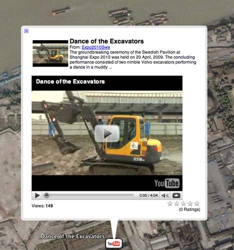
(The video is not exactly awesome — but we now know how good the videographer we hired is.) YouTube is blocked in China as of a month ago, because the authorities disapprove of some of the videos posted there. Since our main audience is Chinese surfers without the technical skills or budget to use Tor, proxy servers or VPNs, this channel is not currently the most effective in China. But at least there is always a point to having the Google Earth popups visible to Chinese users, with a dead link, to remind them they are being protected from dangerous information by their government’s hardworking gatekeepers.
- Google Earth Community: I have no doubt that Google will have updated imagery of the Expo site as it evolves over the coming year, and we’ll make sure that the Swedish pavilion gets its own placemark on the Google Earth Community site. At the very least, Google searches for it will now link the name and website to a place.
- Wikipedia: I have no idea if people will make Wikipedia articles about individual pavilions — perhaps the Chinese Wikipedia will have them. I think it is unethical to market yourself via Wikipedia by penning your own article, but if somebody else writes one, I will make sure it contains accurate coordinates, so it can be found on all mapping tools that show Wikipedia content as a layer (and there are quite a few).
- 3D models: The pavilion already exists as an architect’s 3DS Max file, so it’s a relatively small step to export the model to a Collada file, add photo textures, and submit it to Google’s 3D Warehouse as a georeferenced 3D model (and even to Virtual Earth 3DVia — if Microsoft ever releases a 3D browser plugin for operating systems other than Windows.).
These are the places on my radar screen. Now over to you — where else on the geographic web should I be place marketing?
(Instead of beginning each post by apologising for the recent dearth of posts, from now on please just assume such an apology with every post. The truth is, travelling between China and Europe is no commute and I did just that to attend a wedding te previous weekend — georeferenced panoramic evidence here — and since I’ve been back I’ve been involved in another massive time waster — moving into my new apartment. Add to that a lack of internet access at home (until just now!) and you get the picture.)
Since I’ve been thinking about this for my trip, here are a few other place-marking thoughts:
1) cross-post important photos to Flickr and PicasaWeb Albums (with geotags); 2) photo-overlay any panoramas or photos for Google Earth (and post them to GEC); 3) create a GE plugin for your web site and use a GE Tour (with music background) to show off all your content (including 3D) and create some geo-spatial perspective on the location; 4) Take some aerial photos (use a kite maybe?) and placemark them (if really unique, submit to Google); 5) If your 3D content is really unique, maybe Google SketchUp will feature your modeler;
Your wedding shot is brilliant! The setting with the large painting on the ceiling is perfect for a 360 panorama…and 360Cities shows it off perfectly (especially combined with the other panorama showing the front of the building).
Overall, I’d suggest not dual posting photos to PicasaWeb and flickr, but to post quite separate sets to each site – consider the end user who may well end up seeing your material via some third party service that pulls from both of these – and you’d do better to have two different pictures as the number one match on each, rather than getting the same photos duplicated.
We here on the Photosynth team are excited to be included in your project, best of luck and let us know if you have questions that we can help with :)
What about all news articles served as GeoRSS