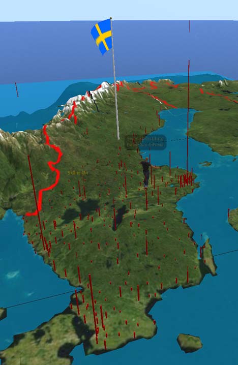
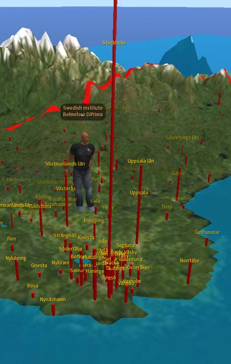
Swedish programming virtuoso Magnus Zeisig as just published an accurate 3D map of Sweden in Second Life that can be scripted to show all kinds of data and run all sorts of animations. You can visit it in Second Life here, and it looks like this:

How did he make it? Magnus writes:
Topography data were processed using PERL programs of own design. Topography data and geographic data were conically projected using the program DAZ/Eovia Carrara. Population and area data were processed using Microsoft Excel and Visual Basic programs of own design. Final topographic sculpt, geographic and heraldic images were prepared using Adobe Photoshop.
Magnus used Second Life’s sculpted prims to build the landscape, and on top of it you can today turn on/off “layers” with city names and cylinders that represent population, which is done using the Linden Scripting Language. (When you visit, click on the map for animation options and more info.)
Magnus has more in store, including a search function and animations for ship and rail traffic. It certainly not as easy as making a quick and dirty KML file for Google Earth, and no doubt takes more work than building something with the new Google Earth API, but when it comes to programming an interactive 3D map to measure, this example shows it’s certainly feasible in the versatile 3D programmable space that is Second Life. (Previously on Ogle Earth: Magnus’s planetarium in Second Life)