Yet another great GPS tool for Mac users: GPS Automator Actions by Austria’s Sigurd Buchberger lets you use Mac OS X’s built-in scripting tool to download data from connected GPS devices, convert that to KML and many other formats, and also upload to GPS devices. Like so:
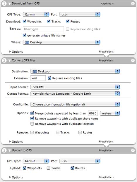
It’s open-source, uses GPS Babel, and the source code is available.
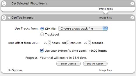
Then, if you like, use the downloaded GPS data to georeference photos with Sigurd’s GeoTagging Automator Actions. They come as a two-week trial, and cost $15 thereafter. Here’s how to geotag iPhoto images:
(Once you’ve done all that work, why not export them as a KMZ file using Craig Stanton’s iPhotoToGoogleEarth?)
One cool feature in Sigurd’s geotagging actions is the concept of the Trackpool. From the info box:
The trackpool is a database where a user can store all his tracklogs. This allows more efficient workflows because you don’t have to explicitly name the gps tracklog and you can use multiple tracklogs at the same time.
The ensemble pretty much completely automates the geotagging workflow on a Mac.
You can also geotag images with GeoTagger>. Just position Google Earth over the loation you want and drag your image to the GeoTagger icon. Works with images dragged from iPhoto and the OS X Finder. I’d love $15 per user, but I’m giving it away as donation ware because many parts of it, as I suspect these Automation actions do, use libraries produced by other people.