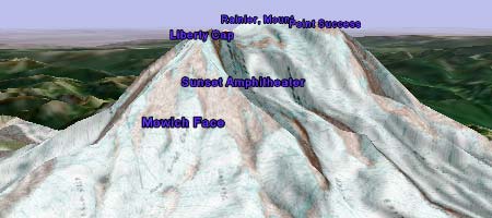
Google Earth lets you add image overlays. This has already been used to great effect to dynamically track weather and traffic. But you can also use this feature to add geographic detail to more static features — for example, by adding a topographic relief map of Mount Rainier and then turning on the terrain function, which lets these maps stand out in a whole new way.
Topozone is one place where you can download USGS maps. They have a free demo that lets you try out some downloads (including this Mount Rainier map), but you’ll need to get a subscription before you can download detailed maps of the regions you want.
A whole further dimension is revealed if you use historical topographic maps as overlays. These are available free on Maptech’s Historical Maps site, which contains high-resolution downloadable USGS topographic maps from around 100 years ago for most of the Eastern Seaboard. In this context, the transparency slider acts as a great timeline for seeing how towns have developed over the past century.