[Update January 7m 2009: An automatically updated version of this map can now be found here. (Accompanying post).]
The Middle East Strategy at Harvard blog made me aware of a just-released UNOSAT map detailing the attacks inside and around the Gaza Strip from Dec 25 and up to Dec 31, 2008 (yesterday). The map is available for download from the UNOSAT site as a PDF. I downloaded it, rasterized it and geopositioned it in Google Earth as an image overlay. Download the KMZ file for an overview of this latest war on Google Earth.
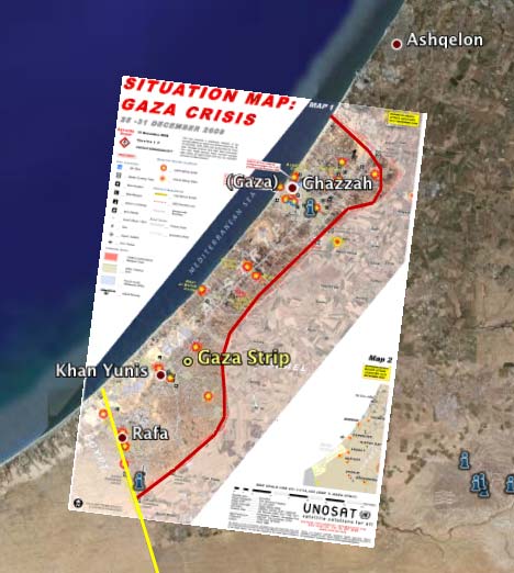
As usual, play with the transparency slider for the overlay to switch between the map view and the underlying view of Google Earth.
UNOSAT continues to update the map, so do go and get yourself the latest one if you don’t read this post today.
Stefan-
I just posted a Gaza map comparison over at Aid Worker Daily. It shows the difference between Google Maps, Microsoft Virtual Earth and Open Street Map. Here’s the link: http://tinyurl.com/95suua
Cheers,
Jon
you give no info