
FortiusOne‘s GeoCommons is a free web-based geospatial analysis and cartography tool that also allows you to upload, share and remix datasets, and it is being relaunched today. It packs quite a punch.
But first some history. GeoCommons was originally launched at Where 2.0 in 2007. Over the past year, feedback from neogeographers who most need such a service led FortiusOne to completely redesign the service, and also to team up with Mapufacture, who have been working on similar technologies and goals.
The result is the new GeoCommons, which I’ve had a chance to play with over the past few days. It’s easy to explore — just get a free account and start mapping with heaps of existing datasets, or upload your own.
What makes GeoCommons so intuitive is that the service’s two main functions are clearly delineated — there’s Finder! for “finding, organizing and sharing GeoData in common formats” and Maker! to “make stunning interactive maps with your own data, GeoCommons public data or both.”

Finder organizes the raw content, while Maker deals with the presentation of this content, though the tools that let you make a cool map aren’t just collections of pretty icons, but include nifty widgets for slicing the data so as to maximize clarity. For example, choosing the dataset of recent earthquakes is just the beginning. You then get to massage the data thus before it makes it to the map:


That’s a level of sophistication in end-user web-based geotools I have not seen anywhere else. The best thing is that subsequent users can try their own hand at manipulating the data within the map, or make a completely new map with the same data.
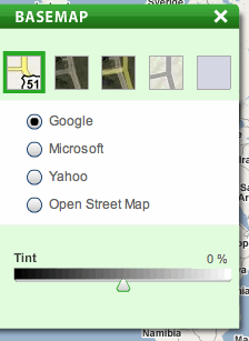
Geocommons is also agnostic when it comes to your basemap:
How can it possibly get better? Well, you can currently link to a map, but you can’t yet embed it on a web page elsewhere on the web. FortiusOne’s Sean Gorman says they have embeddable maps waiting in the wings, but don’t want to burden the servers with it just yet.
Also, if you want to get a dynamic KML network link to the data, you currently have to go via a map rather than directly from a data layer, but that too is just temporary. Writes Sean:
All the KML on Finder is raw data and not network links. So you can only upload raw KML and download raw KML and there is not currently network link support. We are currently working on support for dynamic data that would allow us to support both KML network links and GeoRSS but do not have it ready for launch. This is a big part of what we are doing with the merging of Mapufacture into GeoCommons.
And at the moment, you can’t upload KMZ files yet — they have to be KML, which means you can’t upload overlays. You also can’t upload KML files that reference overlays as URLs. But these are quibbles; GeoCommons takes Shapefiles and all CSV spreadsheets with longitude and latitude columns, and you can also download GeoCommons layers as KML, Shapefiles or CSV spreadsheets.
Have fun exploring this significant new neogeo toolset. As soon as GeoRSS and network link support for datasets is in place, imagine the things you will be able to do with GeoCommons married to Yahoo! Pipes:-)
{Update 13:42 GMT: Mapufacture’s Andrew Turner blogs Maker! and the goals behind this app.]
[Update 14:07 GMT: Sean Gorman blogs the launch.]