New Scientist carries a story today about how some archaeologists are using Google’s aerial imagery as a proxy for an actual excavation because… the site is in Afghanistan, and not exactly safe to visit:
Google Earth’s freely available high-resolution images are helping David Thomas and colleagues at La Trobe University in Melbourne, Australia, to forge ahead with a project called Archaeological Sites of Afghanistan in Google Earth, which catalogues details of 463 potential sites in the Registan desert. These include mounds called tepes – the remains of ancient mud cities – hand-dug underground water channels and villages.
Alas, the article doesn’t show us any of the actual locations covered, but it does point to an interesting conference poster (PDF) made by Thomas and Claudia Zipfel that highlights some of their work on the 10-12th century fortress at Bust on the Helmand river.
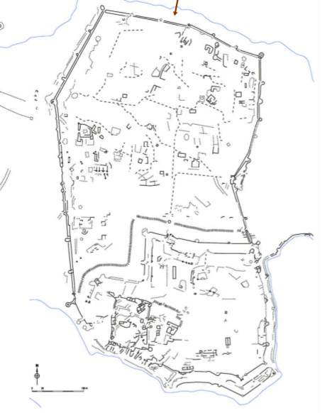
The poster contained enough information to track down the actual location:
The obvious downside to this kind of archaeology is that you are limited to the bits of Afghanistan that are visible in high resolution.