Announced in January, but delivered in August, after Berlin and Dresden: Hamburg’s city center in 3D as part of the buildings layer in Google Earth. Was it worth the wait? It certainly looks good:
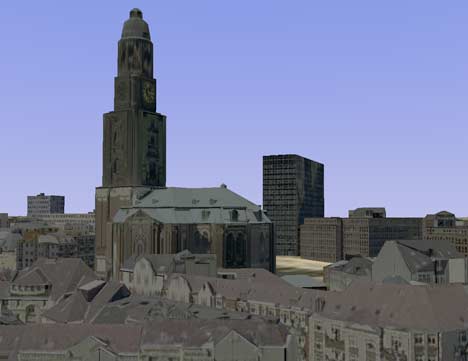
The models are credited to Cybercity AG, and the level of detail is impressive, especially when it comes to the nooks and crannies, though perhaps the colors look a bit washed out. You will also need a graphics card from the future — unless you are really close in, flying around Hamburg is done at extremely low fps… more like fpm, in fact. And because there is so much of it, expect to take some time for it to download.
If you read German, here’s more in the Hamburger Abendblatt. (Thanks Jan Wesbuer for the heads-up!)
Hey, those are some really great ‘hobby accurate’ models there. (Sorry I had to.)
Boy, that sure was a knee slapper.
*rolls eyes*
KoS