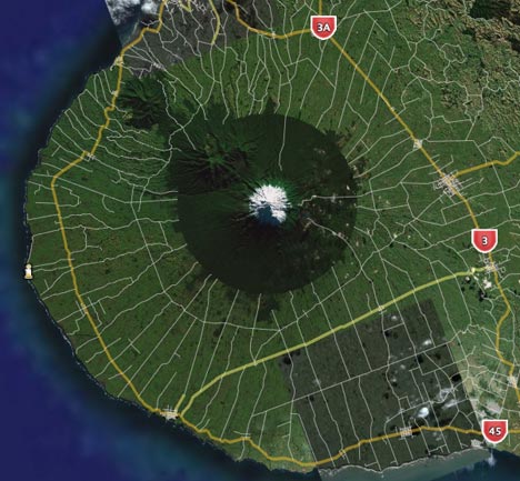
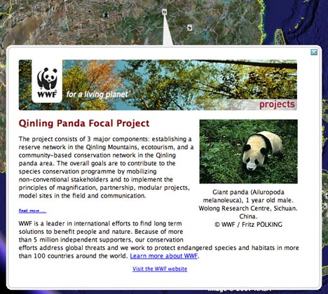
There’s new stuff in the default layers: New Zealand gets road data, the World Wildlife Fund gets to georeference its many conservation projects, and the mountaintop-removal coal mines in Appalachia get before-and-after overlays.
In the existing layers, National Geographic expands its series of georeferenced articles and photographs to include new regions, including both Antarctica and the Arctic region.
Most other existing default layers get updated content. All the details are in this post at Google Earth Community.
The New Zealand roads look great – even some walking tracks are included I see. But there’s still a big problem with New Zealand, which becomes evident when you tilt the view of Mt. Taranaki shown above. The terrain DEM is woefully poor resolution – the topographic summit of Taranaki appears a few thousand feet from the imaged summit.
Of course, it’s the same for much of the world still, but the Southern Alps with their spectacular landscapes really deserve to have the same high-quality terrain data that their sisters to the north now have.