DestinSharks: Vector marine charts for Google Earth (beta)

Thursday, December 21, 2006 (06:12 UTC)

Are you a boater or boater-curious? DestinSharks is looking for beta-testers for its latest cool tool — EarthNC, marine charts for Google Earth:

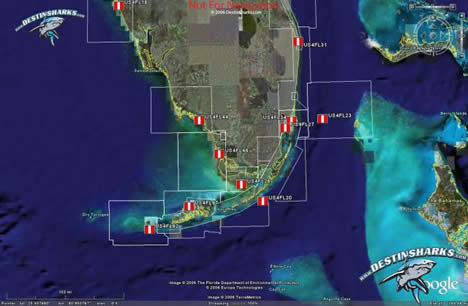
We’ve been hard at work for over 6 months to provide an ‘Earth’ alternative for NOAA ENC® vector charts covering US coastal waters. When fully released, DestinSharks.com will offer the full catalog of 600+ NOAA vector charts. Each EarthNC™ chart features the same elements (buoys, channels, lights, etc.) found in the original ENC files - complete with a custom marine icon set for Google Earth.

floridadn.jpg

Get the details here.

Permalink | Del.icio.us | Connotea

Comments

Post a comment


Remember Me?


(you may use HTML tags for style, and also <a>)

Note: After your comment has been submitted, you may need to reload the page before it becomes visible.

Search Ogle Earth:
Ogle Earth brings you news about virtual globes, with a special focus on Google Earth. By Stefan Geens. Email me. Last tracked here:
Get updates via email:

NeoGeo Jobs

Ogle Earth: Recent posts

Archives