So ESRI ArcGIS Explorer is also opting for the soft launch — either that, or it is putting its trust in security through obscurity, which in the age of blogs is rather optimistic. James Fee shows the way: Follow this link to the download, though you will first need to set up an “ESRI Global Account”, which I did without problems or needing to use credit card info.
First impressions of ArcGIS Explorer? Hmm:
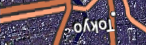
I guess I had taken it for granted that in virtual globes text info would simply face me, especially as both Google Earth and NASA World Wind manage to do it, and since the whole point of having a virtual globe is that you get to choose the perspective. But now Microsoft Virtual Earth and all the “globes” I’ve tried in ArcGIS Explorer put their labels in rasterized layers that assume you’re facing North and looking straight down at the ground.
Imagine if that’s how Second Life worked with labels and such — always horizontal, facing North. You’d go bonkers. Instead, they face you. Why would information dissemination on a virtual globe be any different? Either because it is difficult to do, or because old thinking about maps continues to dominate the new technologies for viewing geospatial information. A virtual globe, just like a virtual world, should be about you.
I haven’t had the time to get much more of an impression of ArcGIS Explorer, so that will have to wait for another post. Data loads relatively slowly at the moment (maybe because servers are still not ramped up) and navigating across the poles is equally screwy as in Virtual Earth (and, BTW, NASA World Wind.) People, there is nothing special about the poles. Why can’t I drag myself across them? Planes do it all the time in real life.
I’ve flied a little bit, but then my program seems blocked. However, I’ve managed to export a place. First option, it prompts you to save the location in some URL of theirs: In my attempt, it was http://services.arcgisservices.com/348//Explorer//Maps/
however, there’s nothing there, though it seems that services.arcgisservices.com is designed to host something, perhaps a shared repository or community of places like the G Earth BBS community?
Anyway, you can save the location as a local file with extension .nmf (the ArcGisExplorer format). This format has been mentioned here and there, though I haven’t found very much documentation.
I also had crashes until I made Internet Explorer my default browser. This is not a scientific observation, though:-)
Stefan, you live too close to the poles. Must of us down near the middle of the globe never really head up there. ;)
ArcGis Explorer while not software. This see as long presentation, not solution.
I see pseudo XML (nfm). This XML include also call functions. Code+data. Hmm…
ESRI while not player. Maybe next time or other software.
Hmmm…. I have no problem going straight over the poles just like in Google Earth. I’m not sure what problems you are seeing Stefan. I agree with you about the labels though. I have seen screen shots of 3D labels in AGX so it must be supported, but just not in the default data sets ESRI is providing.
Well, if you turn on spinning and let the globe spin across the poles, that’s no problem. But if you try to grab the globe near the poles and bring it towards you, or if you try to drag the pole to the center of your screen, then it behaves erratically.
I’ll try again later and specify exactly when it goes awry. Possibly this doesn’t happen if you’re navigating with keys.
Tools -> Options. Speed / Track Ball Pan
Stefan… Here is the ESRI response to the labels:
“One of the the things you’ll notice when using the globes and maps published initially with the ArcGIS Online services is the use of “rasterized” labels. In designing the services, there was much discussion of the relative merits of raster vs. vector labels.
In general, raster labels offer the advantages of better font placement (e.g. stacked labels, angled text on physical features like mountain ranges, better label de-confliction) and better performance where text is dense. Vector labels offer the advantages of rotating and billboarded text when rotating or tilting the globe and sharper labels at some scales.
For the beta release, the approach taken has been to develop both raster and vector label services so both are available for different uses. The initial globes and maps released use the raster labels. For raster labels, there are two services (named ESRI_BoundariesPlaces_World, ESRI_BoundariesPlacesAlt_World) that are designed for use on dark or light base maps, respectively.
Users who prefer the vector labels, however, can update the globes to use the vector label service (named ESRI_PlaceLabels_World) that is also available on the ArcGIS Online server. Some new globes that are published by ESRI will use this service where appropriate.”
That is in response to the ArcGIS Online forums, but at least gives you some logic into their reasoning.
Thanks for that James. And yes, setting the mouse preference to trackball pan solves my problem. I’ll be revisiting ArcGIS properly when I have some more time in a few days. High up on the list will be evaluating KML support.