Ethan Zuckerman and Jason Kottke have blogged the release of aerial imagery by the American Association for the Advancement of Science (AAAS) showing the disappearance of Porta Farm, a settlement of over 6,000 people on the outskirts of Harare, Zimbabwe. It is one of the direct effects of Operation Murambatsvina, Mugabe’s forced slum clearing program from 2005.
The AAAS press release links to two images of Porta Farm it commissioned from DigitalGlobe, one taken in 2002 and one taken in 2006, after the razing. These images are not georeferenced, however, and have not been given the wider context that an overlay in Google Earth can provide. How far from Harare is Porta Farm? Why might it have been targeted for demolition?
I went looking for the precise spot in Google Earth where these images were taken. I noticed that on the most recent image, a road is being turned into a highway, so I followed the only highway west from Harare, hoping to find features similar to that shown in the images. I soon found the place, a little beyond Google Earth’s built-in high resolution base layer for Harare. It looks indeed like Porta Farm’s crime was lying too close to a “modern” highway — turning it into a constant reminder of Mugabe’s questionable national development priorities.
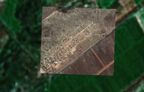
(2002, Image credit: DigitalGlobe)
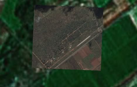
(2006, Image credit: DigitalGlobe)
You can see both images in their proper context via this KMZ file (1.1MB). Double-click on the folder to zoom in. Play with the individual transparency sliders for each image layer to see the comparison.