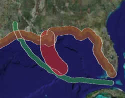
 Brian Timoney and his group have released another impressive demonstration of Google Earth’s usefulness as an analysis tool — Gulf Impact: The energy impact of Rita and Katrina. It lets you upload a hurricane path in the Gulf of Mexico (or use the supplied path for Katrina or Rita), specify a impact zone of arbitrary size around it, and then have the server calculate the amount of oil and gas production that such a hurricane would affect inside this zone. All this is then rendered onto Google Earth, with plenty of additional static layers for context.
Brian explains it a lot better on his site, and in any case you really need to see this in action. Coming up next: An interview with Brian Timoney.