Did Google Earth Violate US Law? asks WebProNews’s David Utter in an article that builds uncritically on the Israel National News article, which in turn got its mangled facts from the Globes article blogged previously.
How is this latest article in error? Let us count the ways.
1) Google has not limited the resolution of its images of Israel (see here for more).
2) Images of Israel will not “be reduced to two-meter resolution,” the main reason being that the resolution of Israel in Google Earth and Maps is currently actually much lower than two-meter resolution. Getting two-meter resolution imagery of Israel would require a vast upgrade of Google’s offerings in the region.
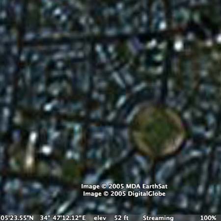
Here is what a section of Tel Aviv currently looks like in Google Earth, at full resolution (reference in Earth [KML], Maps):
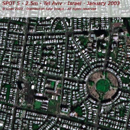
Here is what that section would look like if Google Earth bought 2.5-meter imagery from Spot Image, a French satellite imagery provider:
3) In other words, it is absurd to write something like “If those images were not at two-meter resolution already, Google may have been in violation of federal law.” But that is what reporters who rewrite stories from a single source without checking their facts are indeed capable of writing.
4) Another reason why Google cannot be in violation of the US law in question is because Google is not an American “private remote sensing operator”, i.e. a US satellite operator, but a purchaser of data from such operators. US law only restricts US satellite operators. Google is free to purchase publicly available data from any vendor anywhere, and at any resolution.
Thanks for clearing this (should be obvious but appearantly for many reasons isn’t) issue.